
It's widely used across industries such as construction, utility locating, archaeology, environmental studies, and geotechnical engineering. Whether you’re trying to locate underground utilities before excavation, inspect concrete structures, or investigate environmental sites, GPR delivers reliable and rapid subsurface data without digging or drilling.
As demand for precision, speed, and safety continues to rise, Sensors & Software’s LMX Series — LMX100™, LMX150™, and LMX200™ — has become the go-to solution for professionals seeking accurate underground insights.
What is GPR and How Does It Work?
Ground Penetrating Radar works by transmitting high-frequency radio waves into the ground. When these waves encounter a buried object or a change in material (e.g., from soil to concrete), they reflect back to the surface and are recorded by the system’s receiver. The data is then processed into visual outputs or maps of the subsurface.
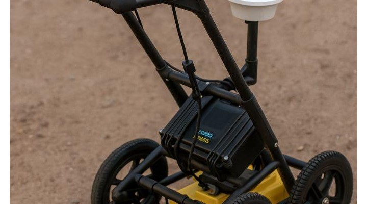
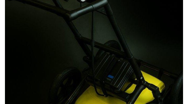
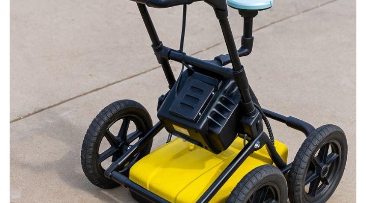
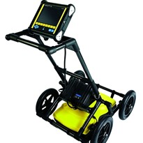
Key components of a GPR system:
- Antenna (emits radar pulses)
- Control unit (collects and processes data)
- Display (visualizes the results)
- Wheels/Cart (for mobility and ease of scanning)
Benefits of Ground Penetrating Radar
1. Non-Destructive Investigation
GPR eliminates the need for intrusive digging or coring, preserving site integrity and reducing associated risks.
2. Real-Time Data Collection
Operators can view live scans while surveying, allowing for immediate decisions and on-the-spot interpretations.
3. High Accuracy
Modern GPR systems, like the LMX series, deliver exceptional accuracy, often within a few centimetres, making them ideal for precision tasks like utility locating or structural analysis.
4. Improved Safety
By locating buried utilities or voids before excavation, GPR helps prevent injuries, equipment damage, and service disruptions.
5. Broad Material Compatibility
GPR can detect objects in various media, including soil, concrete, asphalt, and ice. It can locate:
Metal and non-metal pipes
Conduits
Voids and sinkholes
Rebar and post-tension cables
Rock and groundwater interfaces
6. Cost-Effective
Avoiding service interruptions, legal liabilities, and rework makes GPR an economical solution for many industries.
GPR Applications Across Industries
1. Utility Locating
One of the most common applications, especially before excavation, trenching, or directional boring. GPR helps locate:
Gas lines
Water pipes
Electric and telecom cables
Stormwater infrastructure
2. Construction and Engineering
GPR helps engineers assess ground conditions, detect voids, map reinforcing bars, or verify structural integrity in concrete.
3. Archaeology and Forensics
GPR is invaluable for non-invasive exploration of archaeological sites and forensic investigations to locate unmarked graves or buried evidence.
4. Environmental and Geotechnical Studies
GPR aids in soil layer profiling, contamination mapping, and geological surveying.
5. Transportation Infrastructure
From roadbed and railway analysis to bridge deck inspections, GPR is used to assess subsurface conditions.
Why Choose the Sensors & Software LMX Series?
Sensors & Software, a leading manufacturer of GPR systems, designed the LMX series to provide unmatched utility detection and mapping solutions. Here’s a breakdown of their three flagship systems:
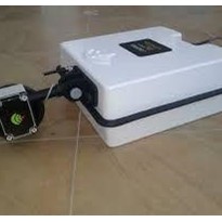
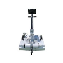
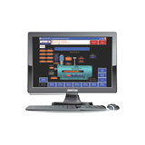
LMX100™ Ground Penetrating Radar
Overview:
The LMX100 is an entry-level yet robust GPR solution designed for locating metallic and non-metallic utilities.
Key Features:
Single Frequency Antenna (250 MHz)
Real-time data visualization on a sunlight-readable display
Depth detection up to 6 meters (depending on soil conditions)
LineTrac™ optional module for locating power signals from live AC lines
Simplified controls for ease of use
IP65-rated, rugged construction for field durability
Ideal For:
Utility locators
Municipal contractors
Surveyors who need a quick and reliable scan without high-end mapping features
Benefits:
Affordable and accessible for smaller teams
Lightweight and portable
Low training curve
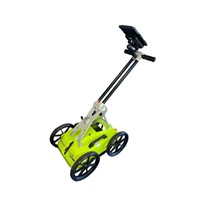
LMX150™ Ground Penetrating Radar
Overview:
The LMX150 builds on the LMX100 platform by adding increased data capabilities and mapping functions, making it ideal for professionals who need better documentation and more in-depth analysis.
Key Features:
5000 MHz antenna with optimized depth penetration
Integrated GPS for mapping and data logging
Optional external GPS for higher precision
Data export capabilities (USB, Wi-Fi)
Depth detection up to 3 meters (depending on soil conditions)
Ideal For:
Engineering consultants
Subsurface utility engineers
Environmental and geophysical surveys
Benefits:
Balance of power and affordability
Adds GPS-based mapping for better reporting
Suitable for both routine and moderately complex jobs
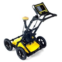
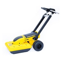
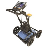
LMX200™ Ground Penetrating Radar
Overview:
The LMX200 is the most advanced unit in the LMX series, offering powerful imaging, enhanced data processing, and multiple interpretation tools.
Key Features:
Full-featured interface
Enhanced data collection modes, including different screen views
Advanced filtering tools for clearer target identification
Built-in obstacle avoidance guides you around obstacles
On-board GPS with optional high-precision GNSS integration
Real-time grid and line scan modes
EKKO_Project™ software compatibility for post-processing and 3D visualization
Ideal For:
Large utility locating firms
Infrastructure inspection teams
Researchers and universities
Consultants requiring deliverable-grade subsurface maps
Benefits:
Industry-leading data clarity
Enhanced workflows and documentation
Ideal for complex, multi-utility environments
LMX Series Comparison Chart
Feature LMX100 LMX150 LMX200
Antenna Frequency 250 MHz 500 MHz 250 MHz
Display Standard LCD LCD with GPS Multifunction LCD
GPS Integration No Basic / Optional External Advanced GNSS
Data Export Limited USB, Wi-Fi Full Suite, Cloud Support
Post-Processing None Basic Full (EKKO_Project)
Use Case Basic Locating Mapping & Logging Full Subsurface Analysis
Real-World Use Cases
Utility Detection Before Digging
Before installing fences, doing directional boring, or laying new infrastructure, contractors use the LMX150 and LMX200 to detect existing buried utilities and avoid costly strikes.
Municipal Infrastructure Surveys
Local councils use the LMX200 to perform non-invasive mapping of buried pipes, stormwater networks, and old sewer systems in preparation for urban redevelopment.
Environmental Site Assessments
Environmental consultants use the LMX150 to scan brownfields, detect subsurface tanks, or identify geological anomalies before remediation or soil testing.
GPR vs. Other Locating Technologies
Technology Can Detect Non-Metallic Utilities? Accuracy Data Visualization Limitations
GPR (LMX series) ? Yes ? High ? Live + Exportable Reduced effectiveness in wet/clayey soils
Electromagnetic Locator ? No ? High (for metallic pipes) ? Limited Cannot detect PVC, fiber, or voids
Acoustic / Thumpers ? No ? Medium ? None Only detects voids or air
CCTV Inspection ? No ? High ? Video Invasive and limited to accessible pipes
GPR stands out as the most versatile and comprehensive subsurface locating method when precision and material diversity matter.
Choosing the Right LMX Model for Your Needs
Choose LMX100 if you’re an entry-level utility locator or contractor looking for a reliable and budget-friendly GPR solution.
Choose LMX150 if you need GPS logging, better data retention, and moderate post-survey reporting functionality.
Choose LMX200 if your work requires advanced data analysis, report-ready deliverables, or integration with EKKO_Project software and 3D mapping.
Conclusion
Ground Penetrating Radar has transformed how industries approach subsurface challenges. From safety and compliance to mapping and analysis, GPR delivers unmatched efficiency. With Sensors & Software’s LMX100, LMX150, and LMX200, users get scalable GPR systems tailored to every project size — from simple utility locating to advanced geophysical exploration.
Whether you're protecting lives by avoiding utility strikes, improving infrastructure planning, or conducting complex environmental surveys, the LMX series offers precision, performance, and peace of mind.


-205x205.jpg)